Software Expertise
Operating internationally and with many clients we have expert knowledge of multiple (geo)modelling tools. More importantly we understand how these applications work and how to get the best from them. Some of the common tools we use are:
Petrel – from SIS. We have used this for the last several years and operate it in our offices. We hold advanced expertise in using this tool in both exploration and development terms. We have developed several intricate scripts allowing us to obtain additional efficiencies.
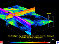
GOCAD – Earth Decision Sciences’ flexible 3D static modelling tool. Experience in using this range from Basin model preparation to complex structural model generation in Europe, GOM and West Africa
RMS – Roxar’s advanced 3D modelling tool.
Jewel Suite – from JOA – This is a new 3D modelling tool with a revolutionary 3D gridding methodology that is very effective in difficult structural systems. A number of our geologists have already been trained in this tool and are able to provide Jewel Suite modelling services
|

Petrosys - state of the art 2D mapping system from Petrosys Pty Ltd Australia. Modern alternative to CPS-3 & ZMap+.
CPS-3 – Schlumberger GeoQuest’s principal 2D modelling and mapping tool. We operate this using advanced macro streams to produce fast, repeatable and auditable work.
Z-Map+ – We use this for strictly 2D modelling and mapping projects with a bias to exploration rather than production.
|